Bhutan Map: All Regions & Places at a Glance
Last updated:
Bhutan is nestled between the giants of India and China (Tibet) on the southern slopes of the eastern Himalayas. With an area roughly the size of Switzerland, the kingdom offers remarkable landscape diversity – from subtropical valleys in the south to glaciated peaks in the north. This page provides an overview of all regions and helps you decide which areas to explore on your journey.
Where is Bhutan?
Bhutan is located in South Asia, specifically on the southern foothills of the eastern Himalayas. The small kingdom borders the Tibet Autonomous Region (China) to the north and India to the south, east, and west – particularly the states of Sikkim, West Bengal, Assam, and Arunachal Pradesh. With an area of approximately 38,400 km², Bhutan is about the size of Switzerland.
Over 80 percent of Bhutan lies above 2,000 meters elevation – it is one of the most mountainous countries in the world. The country is divided into three zones: the subtropical Duar plains in the south, the middle mountain region (2,000–3,000 m) with the main settlement areas, and the alpine high mountain region in the north with glaciers and passes exceeding 5,000 meters.
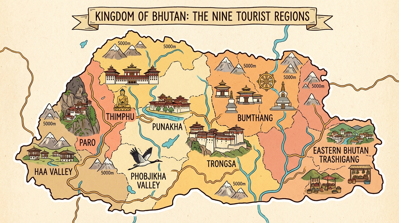
Bhutan Map: All Regions at a Glance
The following map shows the main tourist regions of Bhutan. Click on a region to learn more about its highlights, attractions, and best time to visit.
Jump to Region:
All Regions at a Glance
Bhutan can be divided into three main tourist areas: Western Bhutan with the international airport as the entry point, Central Bhutan with its spiritual centers, and the less-visited Eastern Bhutan. Each region has its own character – from the lively capital to remote valleys where time seems to stand still.
Western Bhutan – Gateway to the Kingdom
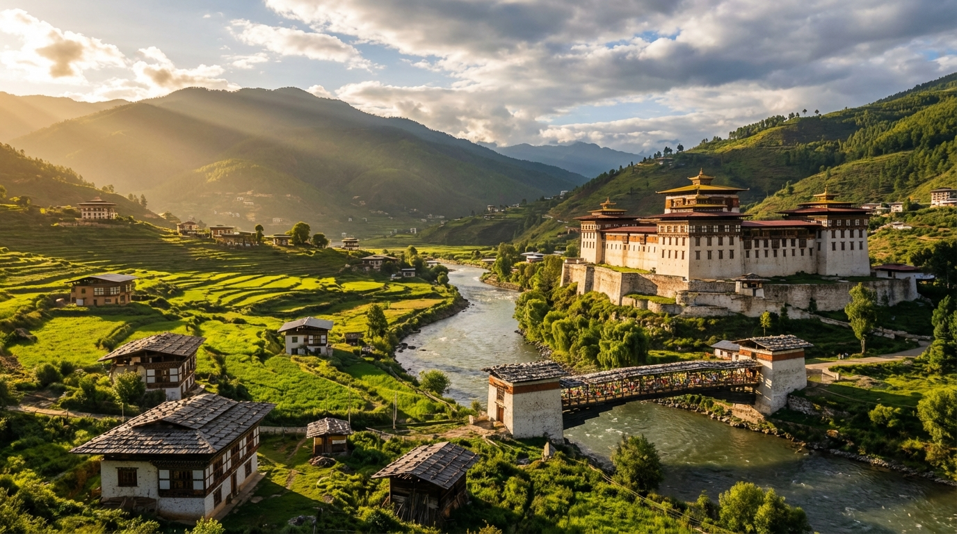
Western Bhutan is the tourist heart of the country and the starting point for almost every Bhutan journey. Here you'll find Paro International Airport, the capital Thimphu, and some of the most famous attractions – above all, the legendary Tiger's Nest Monastery. The well- developed infrastructure and shorter distances make this region ideal for first-time visitors.
 Entry Point
 Paro
Gateway to Bhutan: International airport, the iconic Tiger's Nest Monastery, and the historic Paro Dzong in a picturesque valley at 2,250 m.
 Highlight
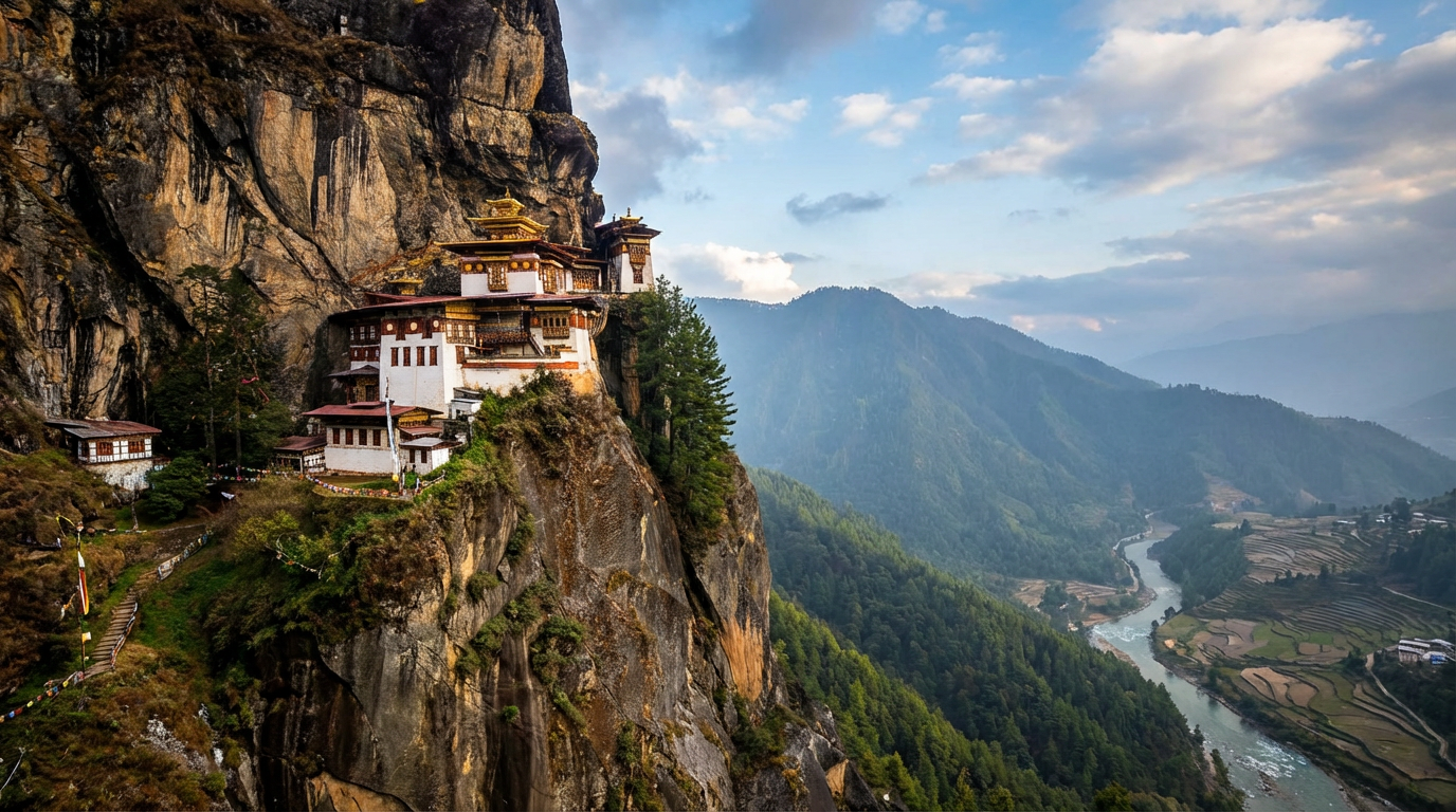
 Tiger's Nest (Paro Taktsang)
Bhutan's most famous landmark: The monastery clings spectacularly to a 900 m high cliff face. The hike is part of every Bhutan journey.
 Capital
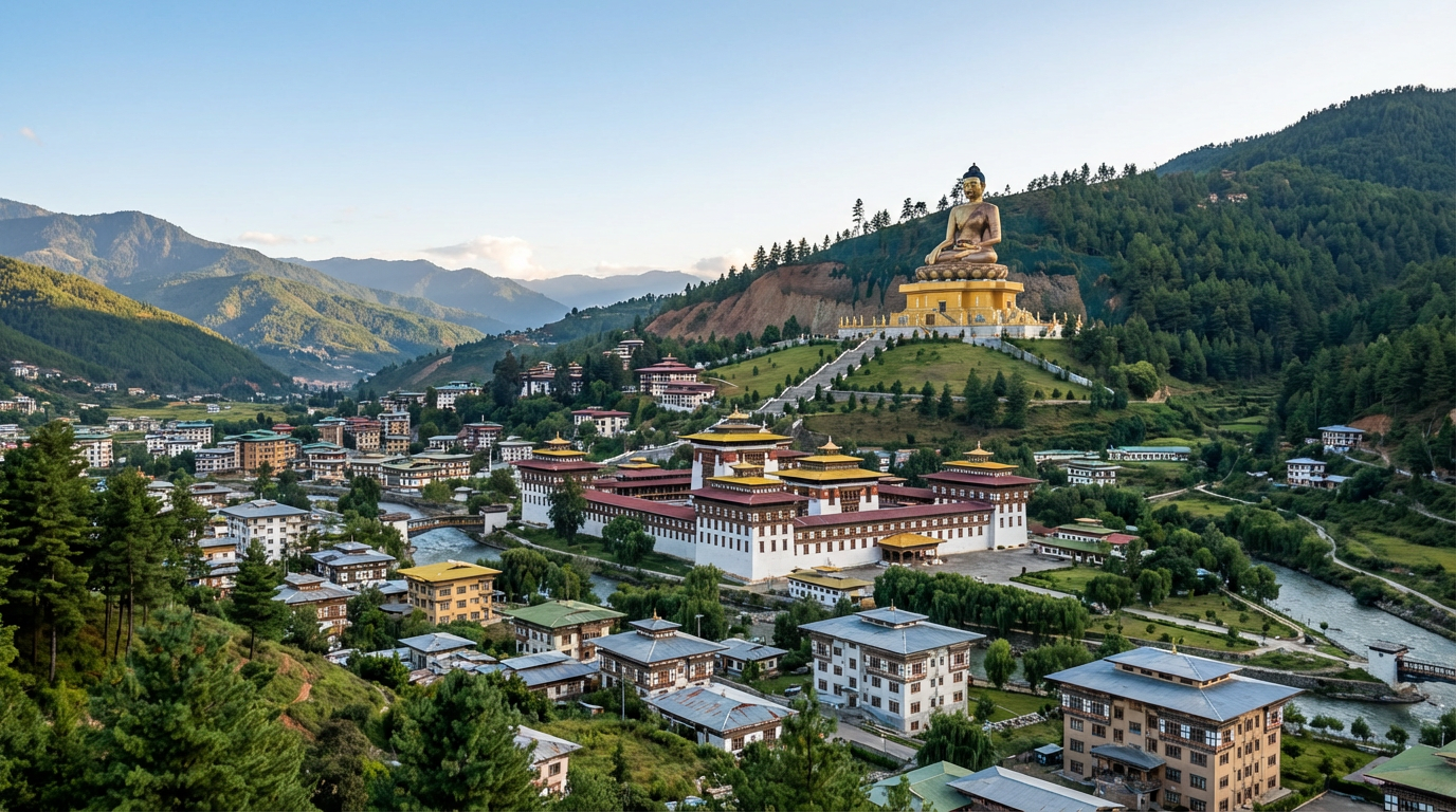
 Thimphu
Bhutan's capital combines tradition and modernity: Tashichho Dzong, Buddha Dordenma, and the only capital in the world without traffic lights.
Haa Valley
The hidden valley on the Tibetan border: Rarely visited, authentic villages, and the popular Haa Summer Festival.
Central Bhutan – The Spiritual Heartland
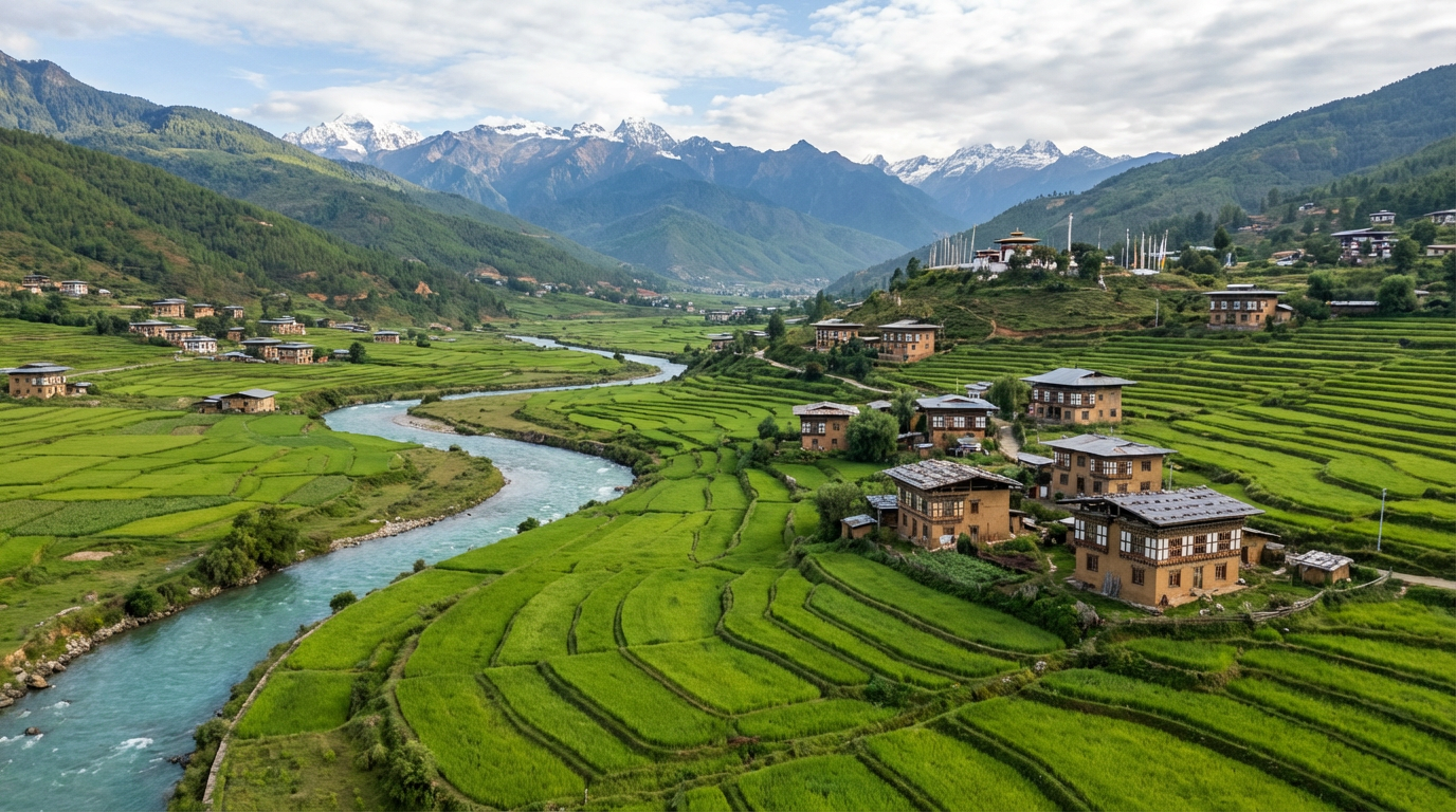
Central Bhutan is considered the spiritual and historical heart of the kingdom. Here you'll find the most magnificent of all Dzongs in Punakha, the mystical Phobjikha Valley with its black- necked cranes, and the ancient monasteries of Bumthang. This region requires more travel time but rewards with deeper insights into Bhutan's culture and spirituality.
 Highlight
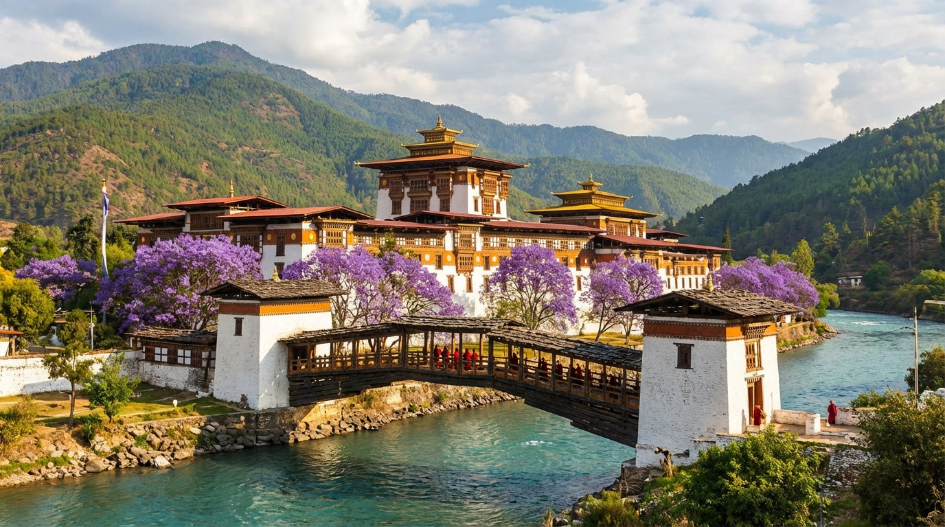
 Punakha
Bhutan's most beautiful Dzong at the confluence of two rivers, the legendary suspension bridge, and warmer climate – ideal for rice paddies and citrus fruits.
 Nature
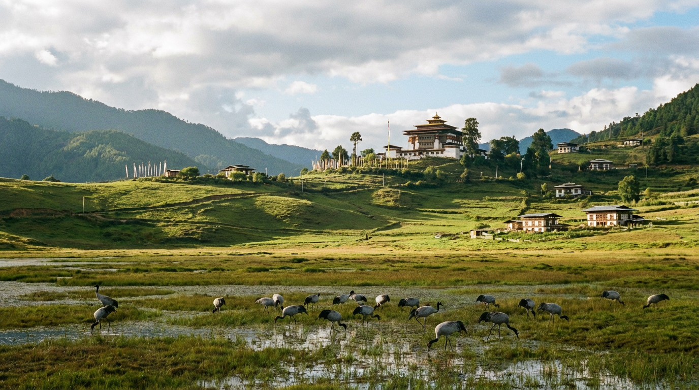
 Phobjikha Valley (Gangtey)
Glacial valley at 2,900 m: Winter home of the rare black-necked cranes, the impressive Gangtey Monastery, and pristine nature.
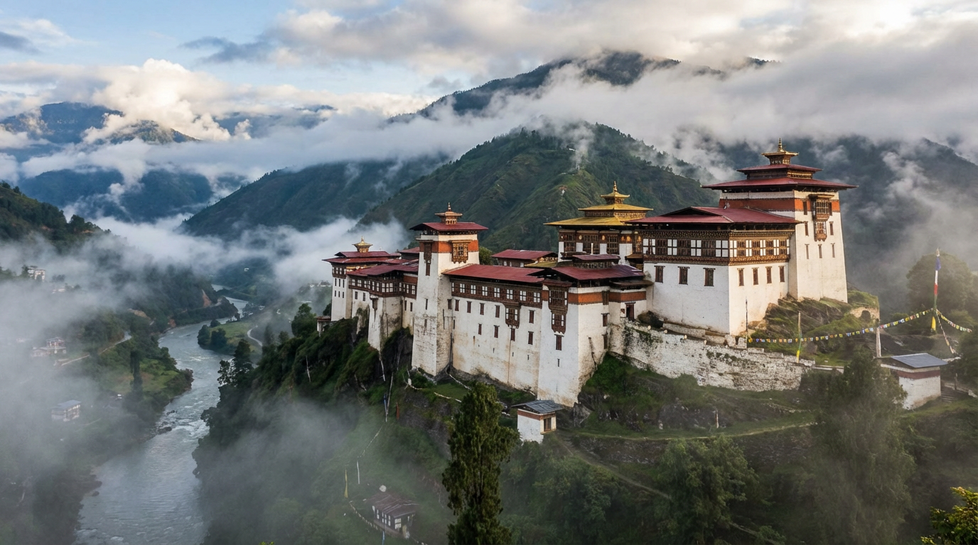
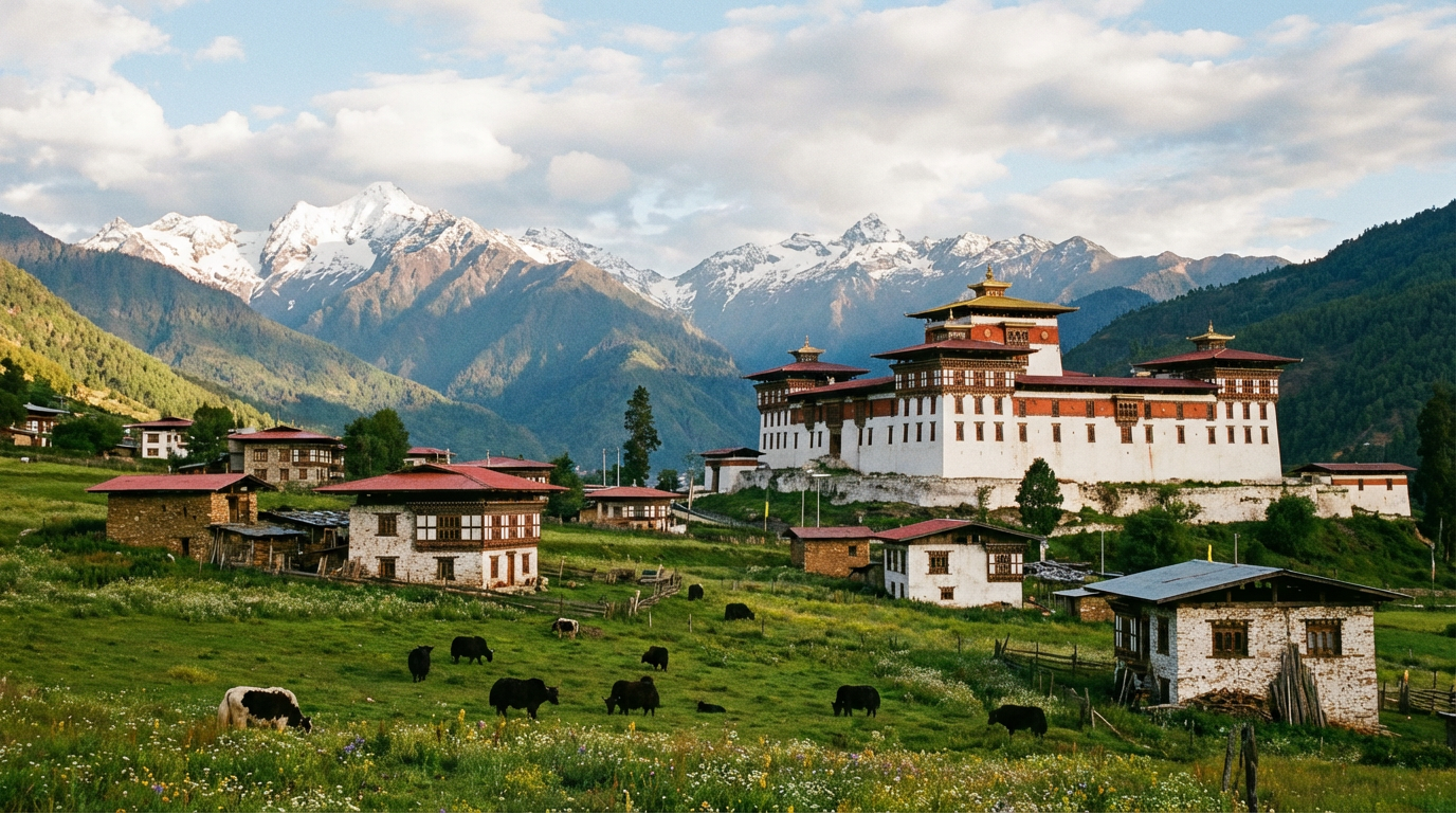
Trongsa
Strategically located fortress in the heart of Bhutan: The mighty Trongsa Dzong towers over the valley and tells the story of the royal dynasty.
 Spiritual
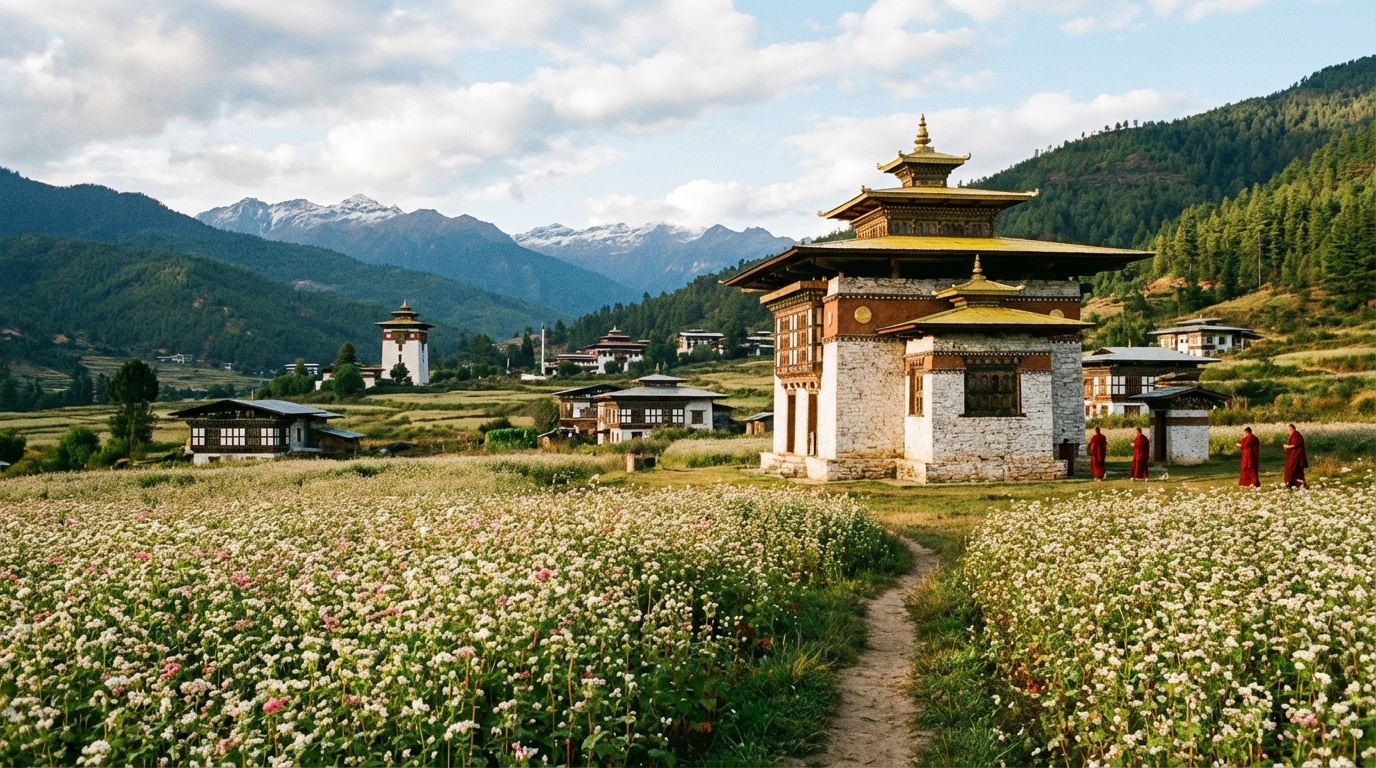
 Bumthang
Spiritual center with four sacred valleys: Ancient monasteries like Jambay Lhakhang, local cheese, honey, and the Red Panda Brewery.
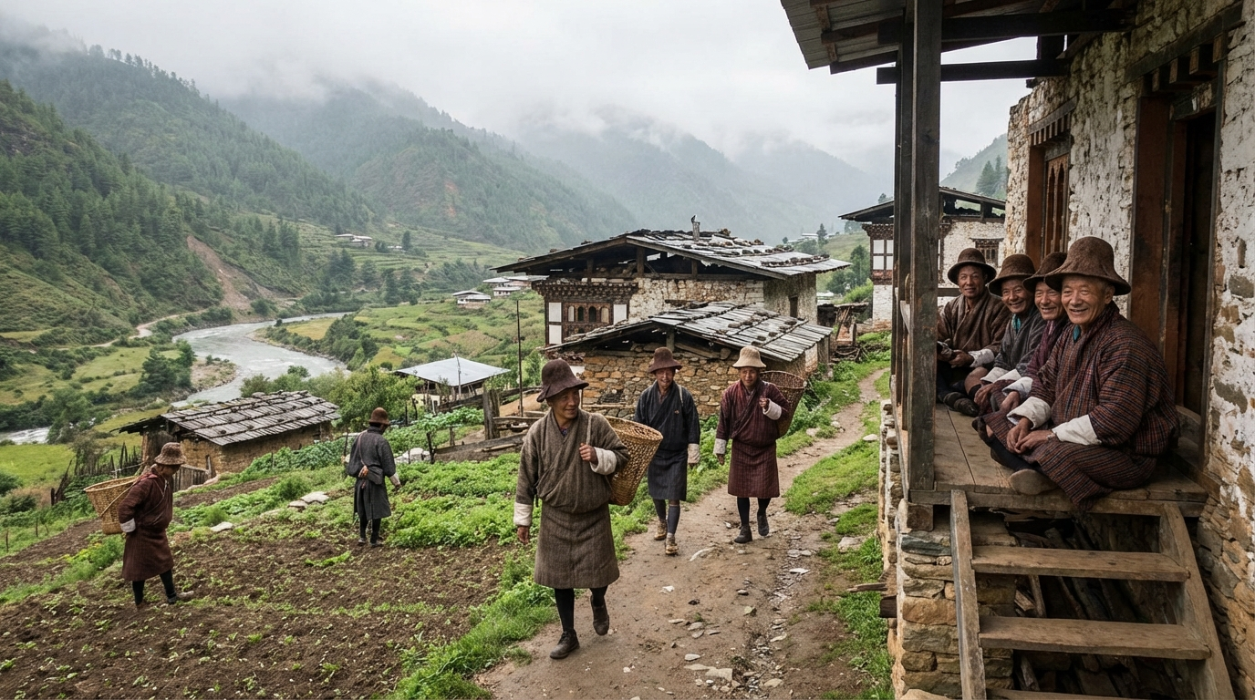
Eastern Bhutan – The Authentic Hinterland
Eastern Bhutan is the least visited area and offers the most authentic Bhutan experience. Long driving times and simpler accommodations deter many – but those who embrace it will encounter the unique Brokpa culture in Merak and Sakteng, hardly any other tourists, and a Bhutan that has barely changed for generations.
Which Regions for How Much Time?
When planning a Bhutan trip, available time is usually the deciding factor. The distances are manageable, but the winding mountain roads require time. The following overview shows which regions you can realistically explore within your timeframe.
| Travel Duration | Recommended Regions | Character of Journey |
|---|---|---|
| 5–7 Days | Paro, Thimphu, Punakha – the "Golden Triangle" | Compact: The key highlights of Western Bhutan |
| 8–10 Days | + Phobjikha Valley or Haa Valley | Extended: More nature or a secluded valley |
| 10–14 Days | + Phobjikha and Bumthang (via Trongsa) | Balanced: Discover the spiritual center |
| 14–17 Days | All central regions + Haa or a trek | In-depth: Time for hikes and details |
| 17–21+ Days | + Eastern Bhutan (Trashigang, Merak/Sakteng) | Comprehensive: The complete Bhutan experience |
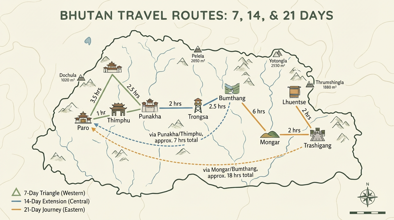
View detailed route suggestions →
Driving Times Between Destinations
In Bhutan, distances on the map can be deceiving: Winding mountain roads, pass crossings, and occasional construction sites make driving times longer than expected. A 70-km stretch can take three hours. Plan accordingly and enjoy the spectacular views along the way – they are part of the travel experience.
| Route | Distance | Driving Time | Notable Features |
|---|---|---|---|
| Paro – Thimphu | 55 km | 1–1.5 hours | Well-maintained road along the river |
| Thimphu – Punakha | 77 km | 2.5–3 hours | Over Dochula Pass (3,150 m) – Himalayan panorama on clear days |
| Punakha – Phobjikha | 70 km | 2–2.5 hours | Mountain roads through forests and villages |
| Phobjikha – Trongsa | 90 km | 3–4 hours | Over Pele La Pass (3,420 m) |
| Trongsa – Bumthang | 68 km | 2.5–3 hours | Over Yotong La Pass (3,425 m) |
| Bumthang – Mongar | 190 km | 7–8 hours | Over Thrumshingla Pass (3,780 m) – full day trip |
| Mongar – Trashigang | 90 km | 3–4 hours | Winding road through remote villages |
| Paro – Haa | 65 km | 2 hours | Over Chele La Pass (3,988 m) – Bhutan's highest drivable pass |
Learn more about transportation in Bhutan
Altitudes and Climate by Region
Altitude affects not only the climate but also your physical well-being. Most tourist destinations lie between 2,000 and 3,000 meters – high enough to cause mild altitude symptoms in sensitive individuals. The climate varies greatly: Punakha is subtropically warm, while Bumthang is noticeably cooler.
| Place / Region | Altitude | Climate | Best Time to Visit |
|---|---|---|---|
| Paro | 2,200–2,400 m | Temperate, 4 seasons | Mar–May, Sept–Nov |
| Thimphu | 2,300–2,650 m | Temperate, cool in winter | Mar–May, Sept–Nov |
| Punakha | 1,200–1,400 m | Subtropical, warm | Pleasant year-round |
| Phobjikha | 2,900 m | Cool, humid | Oct–Feb (cranes), Spring |
| Trongsa | 2,200 m | Temperate, often foggy | Mar–May, Sept–Nov |
| Bumthang | 2,600–4,000 m | Cool to cold, harsh winters | April–June, Sept–Oct |
| Haa Valley | 2,700 m | Cool, often humid | May–Sept (Summer Festival in July) |
| Eastern Bhutan | 1,150–3,500 m | Variable by altitude | Oct–April (outside monsoon) |
More about altitude sickness and health | Detailed climate information
Frequently Asked Questions
Where exactly is Bhutan on the world map?
Bhutan is located in South Asia, specifically in the eastern Himalayan mountain range. The kingdom lies between coordinates 26–28° north latitude and 89–92° east longitude. It borders Tibet (China) to the north and is surrounded by India to the south, east, and west.
How big is Bhutan in comparison?
Bhutan has an area of approximately 38,400 km² – roughly the size of Switzerland. However, the country is extremely mountainous: Over 80% lies above 2,000 m elevation, which severely limits usable land. The population of less than 800,000 people lives mainly in the middle valleys.
What is the capital of Bhutan?
Bhutan's capital is Thimphu. With about 115,000 inhabitants, it is also the largest city in the country. Thimphu has a unique feature: It is the only capital in the world without a single traffic light – traffic is directed by police officers instead. The city lies at approximately 2,350 m elevation in the western part of the country.
Which region should I visit first?
For first-time visitors, we recommend Western Bhutan with the "Golden Triangle" of Paro, Thimphu, and Punakha. This region offers the best infrastructure, the most important attractions (Tiger's Nest, Punakha Dzong, Buddha Dordenma), and shorter driving times. Paro International Airport makes Western Bhutan the natural starting point for any journey.
Is Eastern Bhutan worth it for a first trip?
For a first Bhutan trip, we only recommend Eastern Bhutan if you have at least 17–21 days of travel time. The region requires long driving times (Bumthang–Trashigang: a full day), and the infrastructure is simpler. However, the effort is worthwhile for travelers seeking the authentic, barely tourist-touched Bhutan – such as the unique Brokpa culture in Merak and Sakteng.
Can I drive myself in Bhutan?
No, self-driving is not possible for tourists in Bhutan. All visitors travel with a licensed guide and driver. There are practical reasons for this: The winding mountain roads require local experience, there are no international car rental companies, and the tourism system requires accompaniment. Your driver knows the roads, the best photo stops, and the current conditions.
At what altitude are the tourist destinations?
Most tourist destinations in Bhutan lie between 2,000 and 3,000 meters elevation. Paro (2,250 m) and Thimphu (2,350 m) are typical examples. Punakha lies significantly lower at 1,300 m and is correspondingly warmer. The passes between regions often exceed 3,000 m – the Chele La to Haa at 3,988 m is the highest drivable pass.
How many regions are there in Bhutan?
Administratively, Bhutan is divided into 20 districts (Dzongkhags). However, for tourists, mainly nine regions are relevant: In Western Bhutan, Paro, Thimphu, and Haa Valley; in Central Bhutan, Punakha, Phobjikha/Gangtey, Trongsa, and Bumthang; and in Eastern Bhutan, the region around Trashigang. This page focuses on these tourist-accessible areas.
All Regions in Detail
Explore our detailed region profiles with attractions, accommodations, best time to visit, and practical tips for each destination.
Western Bhutan
Central Bhutan
Eastern Bhutan
Planning Your Route Through Bhutan's Regions?
We help you put together the perfect combination of regions for your travel duration. Non-binding and personalized.